Parkers Creek Heritage Trail
A Place and Its People
For more than 10,000 years, people have hunted, fished, worked, and made their homes around Parkers Creek and Governors Run in Calvert County. Just as their lives and cultures shaped our local heritage, the ruggedness of the terrain and the characteristics of the waterways shaped their lives. The environment and its people leave marks on each other and are inextricably intertwined.
Read More
The American Chestnut Land Trust is exploring that relationship in the Parkers Creek Heritage Trail project. There will not be a single trail devoted to history and heritage. The project’s findings will be shared on two dozen interpretive signs distributed along ACLT’s more than 20 miles of trails, reinforced on this website and in a series of public events. Project research began in 2020 and the first interpretive materials were shared in December 2021. The offering will expand during 2024 and 2025.
Life in the region before European contact (11,000 BC - 1600 AD)
Native peoples used the land we now call Southern Maryland during several periods defined by archaeologists, including the Paleoindian (11,000 BC – 9500 BC), Archaic (9500 BC – 1250 BC), and Woodland (1250 BC – 1600 AD).
Read More
A significant number of prehistoric sites identified near Parkers Creek and the Bay date from the Woodland period. Archaeologists believe that indigenous people used this area for short-term resource-procurement camps that supported larger, more permanent settlements near the Patuxent River to the west.
Further Reading/Web Page:
European settlement (ca. 1650 - ca. 1780s)
English landholdings were established in the Parkers Creek area from about 1650 to the end of the colonial period and the American Revolution.
Read More
We have identified 59 land patents, including a handful that consist of surveys and certifications where no patent was granted. (A few more remain to be documented.) Near Parkers Creek, as in other parts of colonial Maryland, a significant number of patents were granted to Protestants who did not conform to the Church of England.
Lord Baltimore, Maryland’s Roman Catholic proprietor, reached out to Nonconformist Protestants as part of his response to the English Civil War and the ascendancy of Oliver Cromwell, a devout Puritan who took power after the beheading of King Charles I. In 1649, Maryland’s Assembly enacted the Religious Toleration Act, a guarantee of freedom of worship to all Christians. The Act inspired similar laws in other colonies and is echoed in the First Amendment to the United States Constitution. It helped attract Puritans to Maryland.
Further Reading/Web Pages:
Maps and story: Colonial-era Land Patents Near Parkers Creek
Narrative about the patents, with interactive maps of locations and an overview of colonial Maryland’s political context.
Maps only: Colonial-era Land Patents Near Parkers Creek
Interactive maps from the preceding item, without the narrative.
Historical Notes on William Parker
William Parker patented Parker’s Clifts in 1658, an action that “named the creek.” Parker’s acquisition is described by a descendant who visited in 2016.
Rural intensification and slavery (1730 - 1865)
The period from about 1730 to 1865 saw an expansion and intensification of agriculture. The more fertile upland areas near Parkers Creek include archaeological sites, at least one of which had been inhabited for 200 years.
Read More
An 1847 maritime chart that showed land use near the water suggests that agriculture peaked in this area in the mid-nineteenth century.
Before Emancipation, several farms in the Parkers Creek and Governors Run area depended upon enslaved labor. The number of enslaved individuals and the names of their enslavers are listed in the federal Census of Slave Inhabitants for 1850 and 1860. In addition, testimony from families seeking pensions for African American Civil War soldiers have helped us identify a handful of the enslaved. Meanwhile, archaeological surveys of Parkers Creek carried out in 1997 and 1998 identified nine house sites from the active period for slavery, four of which appear to have been occupied by enslaved laborers.
This was a period when water-based transportation was the most feasible method for moving farm products to market and carrying passengers to locations on or near the Bay, notably Baltimore. Sailing vessels were critical to transport during this entire period with steamboats playing an ever-increasing role from about 1820 forward. Wharves had not yet been constructed in the Parkers Creek area; commerce was served by landings where small craft moved people and goods to vessels anchored offshore.
Further Reading/Web Pages:
Joseph and Arabella Wallace: Civil War Soldier and Land-owning Farmer
About the family before and after the Civil War; includes information about Arabella’s enslavement.
Burial plot for members of two related families, death dates 1812-1868.
About the Holly Hill farm to about 1900; regarding pre-Civil War period, includes information about the Dare family’s Quaker background and ownership of slaves by some family members.
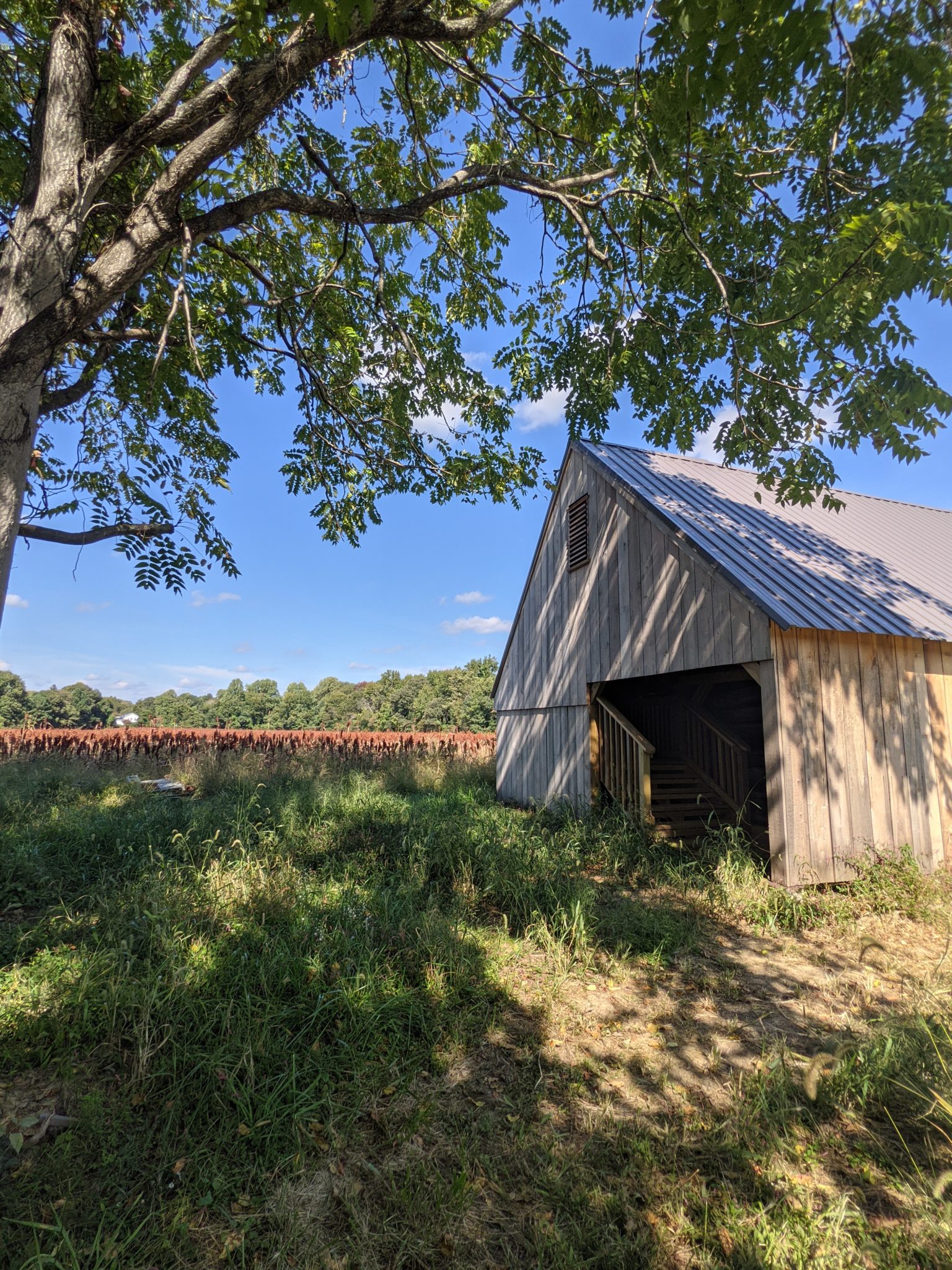
Holly Hill Log Barn
Preserving the Holly Hill Log Barn
About a historic barn on Holly Hill, probably built in the 1830s
William H. and Suddie Commodore: A Parkers Creek Family
Although focused on the family after the Civil War, this text includes information about the enslavement of a pre-Civil War generation in this family.
Additional web pages forthcoming.
Small scale agricultural economy (1865 - 1940)
Following the Civil War, most Blacks in Calvert County worked as tenant farmers, joining the White families who also worked as renters or sharecroppers. However, a significant number of African Americans in Southern Maryland, including a dozen or more in the vicinity of Parkers Creek, became land-owning farmers, sharing the neighborhood with White farmer-owners.
Read More
Joseph and Arabella Wallace, for example, acquired about 275 acres; William H. and Sudie Commodore, about 240; John Walter and Sarah Scales, about 200 acres; and Lemuel Wallace, about 100. White and black residents also worked in commercial fishing and logging to supplement income from farming. Until the mid-1930s, steamboats provided transportation to cities and markets, including the movement of tobacco and other crops to Baltimore. Steamboat wharves were located at Governors Run and Dare’s Wharf.
Further Reading/Web pages:
Joseph and Arabella Wallace: Civil War Soldier and Land-owning Farmer
About the family before and after the Civil War; includes information about postwar land acquisition and other activities.
About the Holly Hill farm to about 1900; regarding post-Civil War period, includes information about the Dare family and the sale of the farm to the Turner family in about 1900.
William H. and Suddie Commodore: A Parkers Creek Family
Includes information about the family’s acquisition of land after the Civil War and their activities from that time to the 1950s.
A Brief History of the Yoe Family and Farm
Information about the family from the 17th century forward, emphasizing 19th and 20th century activities.
Lemuel and Annie Wallace: Farm, House, and Family
About the extended family, tobacco farming, the former dwelling, and barn.
Delois Harrod Johnson and Phyllis Harrod Dawkins recall grandparents’ farm
The sisters spent their childhood in the 1950s and 1960s at a farm on Scientists Cliffs Road south of Parkers Creek; includes video clip.
Additional web pages forthcoming.
Reduction in agriculture, recreational development, and return to forest (1940 - present)
Aerial photos from 1938 indicate that many of the ridges in the Parkers Creek and Governors Run watersheds were still under cultivation before World War II. Steamboat service had stopped and improved highways meant that transportation was by road rather than water.
Read More
After the war, some land on the cliffs fronting the Bay remained in agriculture. Meanwhile, other bayfront sections were bought and subdivided as summer cottage communities, including two at former steamboat landings: Governors Run and Dares Beach. Two others were developed nearby: Kenwood Beach and Scientists’ Cliffs. In the expansive decades after World War II, recreational growth was increasingly reinforced by suburban sprawl. Nevertheless, some land, including significant portions of the Parkers Creek and Governors Run watersheds, remained undeveloped and reverted to forest. Beginning in 1987, much of this woodland was protected by the ACLT, working in cooperation with The Nature Conservancy and Maryland’s Department of Natural Resources.
Funding for the Parkers Creek Heritage Trail project has been provided by the Maryland Heritage Area Authority, part of the Maryland Historical Trust in the Maryland State Department of Planning. The project is one element within the Southern Maryland Heritage Area.