American Chestnut Land Trust

a land conservancy

  • Home
  • About
    • What We Do
    • Staff and Board
    • Mission and History
    • Reports, Publications and Slides
    • ACLT Blog
    • Latest Newsletter
    • Newsletter Search Page
    • ACLT Press Kit
    • Contact Us
  • Climate Change
  • Land & Maps
    • Trails and Trailheads
    • Double Oak Farm
    • The Land
    • Watershed Ecology
    • Parkers Creek Heritage Trail
      • Holly Hill History
      • Holly Hill Log Barn
      • Preserving the Holly Hill Log Barn
      • Indigenous People in the Vicinity of Parkers Creek
    • Cultural History
  • Support ACLT
    • Ways to Support ACLT
    • ACLT Merchandise
    • General Donation
    • Join/Renew Membership
    • Friends Forever – Planned Giving
  • Get Involved
    • Become a Volunteer
    • Volunteer Hours
    • Calendar of Events
    • Guided Canoe Trips
    • Conserve Your Land
    • Southern Maryland Conservation Alliance
    • Watershed Friends Groups
      • Friends of Hunting Creek
      • Friends of St. Leonard Creek
      • Friends of Mill Creek
  • Join/Renew
  • Donate
Home / Friends of Mill Creek

Friends of Mill Creek

A Watershed Stewardship Group
Who we are

The Friends of Mill Creek is a group of individuals advocating for practices that ensure the health and sustainability of our waterways. Partnering with ACLT, we network with similar groups, combining resources to collaborate and support the achievement of shared goals. The Friends of Mill Creek will host events, disseminate information, and recruit diverse and wide-spread community involvement, creating opportunities to build appreciation for the natural resources surrounding us.

Mission

We strive to be action-oriented and inclusive, engaging broad community support from residents, landowners, watermen, business owners, and developers in being stewards of our natural resources. We will focus on science, be informed by data, and act on results. We will accomplish this work while honoring the rich history of our watershed region and being diligent in protecting its future. 

Vision

We envision a future where current residents and future generations accept personal responsibility to act as individual leaders in the stewardship of our watershed in order to maintain a fishable, swimmable marine ecosystem. 

What do we know about Mill Creek?
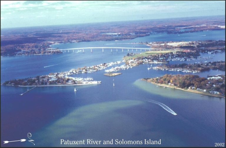
Mill Creek is one of 22 sub-watersheds in Calvert County. Located at the southernmost tip of the county, Mill Creek drains into the lower Patuxent River.
Map of Calvert Watersheds
Mill Creek is an urban watershed
Mill Creek is home to a large number of people and businesses in addition to wildlife and natural landscapes. As an urban watershed, Mill Creek has a relatively high impervious surface cover at 15.2%.
Mill Creek has invaluable ecosystem services
Ecosystem services are the benefits that people receive from nature. Mill Creek offers many of these services, including boating, fishing, swimming, seafood and more. To maintian the quality of these ecosystem services, we must maintian a healthy watershed environment.
Previous
Next

Water Quality Monitoring

A significant facet of the Friends of Mill Creek mission is to “focus on science, be informed by data, and act on results.” In fulfillment of this mission, our Friends completed an initial round of water quality testing of Mill Creek through ACLT’s Water Quality Blitz in April 2022. 

Since 1987, the Chesapeake Biological Laboratory has been testing the tidal portions of Mill Creek, documenting variables such as dissolved oxygen, temperature, salinity, and more. The most recent report is from 2019 and can be accessed here. Because there is already extensive data on the tidal portion of the watershed from the past 30+ years, the Friends of Mill Creek felt it sufficient to cover only non-tidal waterways in the April Blitz. Additionally, because this was the first year of testing, only nitrogen (both nitrate and nitrite, represented by NO23) was accounted for. However, all of ACLT’s friends groups hope to increase the breadth of parameters and frequency of testing in coming years. 

The map below shows nitrogen results for the six non-tidal sites tested in April 2022. Three of the six sites yielded nitrogen concentrations on the upper end of the spectrum, falling in the “stressed to poor” category. As seen by the map, the three most stressed sites are all located in the same general area, in a portion of the watershed near a golf course and other heavy development. These streams all feed into Lake Lariat, however, the water exiting the lake in MC5 has low levels of nitrogen and is considered “good.”

Can you find yourself on this map of Mill Creek?

Resources

Water Quality Update 2022
First Meeting Powerpoint

Upcoming Events:

Get Involved

  • Follow us on Facebook
  • Email tedhaynie44@gmail.com to get on the list
Share

Get Involved

Get Involved

2020 Spring Appeal

Volunteer

Help on the Farm

Conserve Your Land

Sustainable Calvert Network

Calendar of Events

Guided Canoe Program

Join Our Mailing List
Loading

© 2023 American Chestnut Land Trust. All rights reserved. CFC #53731.